Maritime On-Line
Fulfilling various commercial and security-related maritime needs, the Maritime Exchange operates the electronic information center for Delaware River and Bay ship and cargo processing. From ship schedules and real-time vessel positions to Customs and Border Protection cargo clearance status, to meeting manifesting, stow plan, and security filing requirements, Maritime On-Line is the one-stop information resource for Delaware River and Bay activity.

SHIP REPORTING
Your window into Delaware River port activity
Delaware River Ship Movements
Just as it did in the 1800s, the Exchange captures and disseminates anticipated, current, and historical schedules for vessels operating on the Delaware River and the C&D Canal. Ship lines/agents, tugs, barges, launches, terminal operators, ship supply and repair firms, government agencies, and so many other maritime stakeholders depend on Ship Reporting to meet ships on arrival, schedule boardings, expedite cargo operations and meet their own organizational goals. Supported by a VHF radio network that covers the river from Trenton, New Jersey to the sea, the Exchange is steadfast in providing timely, accurate, and reliable ship reporting services 24 hours a day, 365 days a year.
Vessel and Port Schedules
The Operations staff works around the clock to maintain detailed vessel schedules. Each ship call recorded contains a full itinerary, including arrival and departure times, cargo types, contact information, and future orders. The system provides reports and schedules listing current port activity, upcoming ship arrivals, and historical data and is supported by a comprehensive database containing ship dimensions, identifiers, flag administration, owners, and previous ship names.
Reports
Ship Reporting provides a number of vessel schedule and statistics reports, including estimated future activity, current ship locations, and cargo loaded and discharged. Through the custom report writer, subscribers can also design their own queries and reports to analyze ship and cargo trends.
Reference Files
TRACS
Your electronic cargo clearing system
TRACS is a community-based cargo manifesting and release portal certified on the CBP Automated Commercial Environment system. Shipping lines and agents throughout the region, the country, and the world use TRACS to meet electronic ACE filing requirements for ocean import and export manifests, importer security filings, in-bonds, and stow plans.
Participants benefit from the user-friendly interface to upload cargo manifest data or key the information directly. CBP and other partner government agencies respond through TRACS with cargo status messages such as hold, do not load, release, and examination messages. These can be viewed online, emailed, or sent via FTP.
Data owners have complete control to determine who can see their cargo manifests. They can choose to share the information with trading partners such as brokers, terminal operators, trucking companies, warehouses, and other TRACS users or restrict access altogether.
FEATURES
- Cargo manifest edits online or via upload
- Vessel arrivals and departures
- Paperless in-bonds and arrivals
- Permit to Transfer requests
- Importer Security Filing (ISF-5) compliant
- Stow plan submissions
- Second notify party transmissions and status notifications
- VOC/Agent/NVOCC notifications
- Terminal facility release messages
- Contact management function to save frequent shipper, consignee, notify party information
- CBP and PGA status notifications available through the website, email, and/or file transfer protocol
- Available for all U.S. ports of call
REFERENCE FILES
- TRACS FAQ
- TRACS Summary
- TRACS File Transfer Specification
- Status Notification Specification
- Stow Plan Overview
- Sample Letter of Intent (doc)
- TRACS PTT Upload Specification
- CBP Letter of Intent (LOI) Instructions
- CBP Disposition Codes-Appendix D
- CBP Error Codes-Appendix H
- CBP Vessel Registration Form
- CBP National Downtime Policy
- CBP Delaware River Area Local Downtime Policy
- CBP U.S. Port Codes (Sch. D)
- CBP Foreign Port Codes (Sch. K)
Stow Plan
Your system to meet CBP bay plan reporting requirements
The Maritime On-Line Stow Plan module provides a fast and efficient portal to meet CBP’s container location filing requirements. Users can upload standard BAPLIE files or enter the information directly through the website. In addition, the system provides enhanced functionality to batch edit multiple container records to change ports of discharge or loading.
FEATURES
- Upload BAPLIE file versions 1.5, 2.0, 3.0
- Batch editing of port records
- Available for all U.S. ports of call
REFERENCE FILES
AUTOMATIC IDENTIFICATION SYSTEM (AIS)
Real-time vessel positions within the Delaware River and Bay
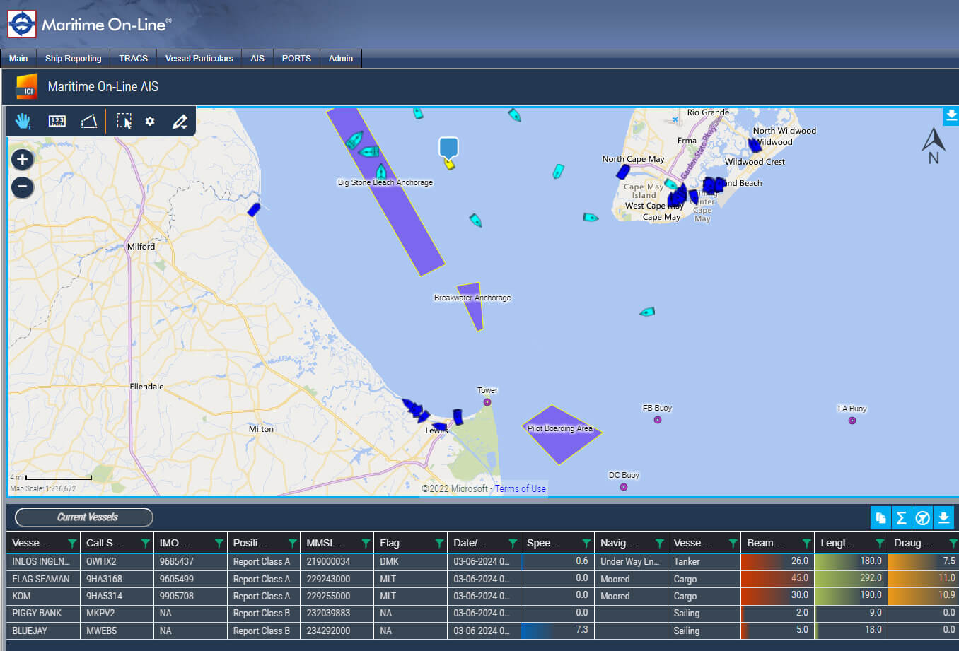
The Maritime Exchange AIS complements and consolidates the vessel schedules and cargo manifest data information included in Maritime On-Line. AIS displays real-time positions of commercial cargo vessels and tugs/barges transiting the Delaware River and Bay and the C&D Canal through a secure and user-friendly website. Available information includes real-time position, course, speed, direction, and other relevant data. The system includes geofencing capability to send activity alerts at physical locations on the waterway or around moving vessels and playback functionality to analyze trends and incidents.
Through single window, users can access vessel positions, schedules, and cargo information. Together with Ship Reporting and TRACS, AIS provides a comprehensive common operating picture of the Delaware River, improves vessel and cargo operations, and enhances maritime domain awareness.
FEATURES
- Links all Maritime On-Line data (Ship Reporting and TRACS) in a single display
- Full AIS coverage of the Delaware River and Bay and C&D Canal
- Terminal facility and anchorage location indicators
- User-defined geofence zones and alerts
- User-controlled filters to customize the display
- Shape and color coding to identify vessel types and speed
- Playback function to display historical vessel movements
FOR MORE INFORMATION
Contact the Exchange today at 215-925-1524 or ops@mxops.org for more information and a personalized tour of Maritime On-Line.
